Indicator unit: Amount of carbon stored in the soil (0 to 30 cm depth), expressed in Mg (megagrams or tonnes) per km2 .
Area of interest The SOCI has been calculated at the country level and for all protected areas and is provided and for each country, each terrestrial ecoregion and each terrestrial and coastal protected area of size ≥ 1 km2.
Policy question: There are two main policy questions to which the SOCI indicator is relevant:
- How do protected areas contribute, through the conservation of soil resources, to the fertility, health and productivity of the ecosystems and to the livelihoods of the local communities that depend on these resources? Soil organic carbon (SOC) is the main component of soil organic matter, which is critical for the stabilization of soil structure, retention and release of plant nutrients, and water infiltration and storage in soil. SOC is therefore essential to ensuring soil health, fertility and food production. The loss of SOC indicates a certain degree of soil degradation, and can happen through unsustainable management practices such as excessive irrigation or leaving the soil bare, without significant vegetation cover.
- How do protected areas contribute to soil carbon storage and hence to offset the impacts of fossil fuel emissions and to climate change mitigation? Soils represent the largest terrestrial organic carbon reservoir. Carbon stored in soils worldwide exceeds the amount of carbon stored in phytomass and in the atmosphere, and is the second largest global carbon store (sink) after the oceans. Changes in land use and land cover can cause SOC decreases and carbon emissions, which are one of the largest sources of human-caused carbon emissions to the atmosphere. Protected areas may contribute to soil carbon retention and hence to the reduction of net emissions of greenhouse gasses responsible for climate change.
---
Data Uploaded by Luca Battistella using the Digital Observatory for Protected Areas Services (2022)
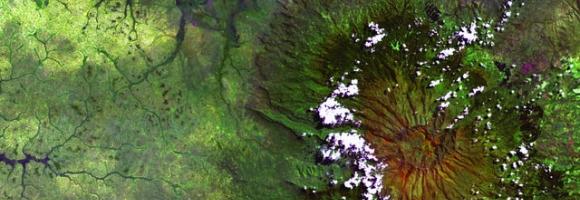
Total carbon
The global map of above- and below-ground terrestrial carbon storage (tonnes (t) of C per km2) merges the following layers: (i) the above-ground carbon, expressed in tonnes of carbon per km2 which corresponds to the carbon fraction of the oven-dry weight of the woody parts (stem, bark, branches and twigs) of all living trees, excluding stump and roots, as estimated by the GlobBiomass project (globbiomass.org) with 2017 as the reference year (Santoro et al., 2019), and (ii) the belowground biomass carbon (BBC), expressed in tonnes of carbon per km2 which represents an estimation of the carbon stored in the roots of all living trees. The BBC is a derived product from two main sources of information: (i) above-ground biomass (AGB) data provided by the global terrestrial biomass map derived from Earth Observation data in the framework of the GlobBiomass project, and (ii) chapter 4 of the 2019 Refinement to the 2006 IPCC Guidelines for National Greenhouse Gas Inventories (IPCC, 2019), which indicates the most updated root-to-shoot ratios (R). The IPCC Root-to-shoot ratios depend on the biogeographic conditions (ecozone), forest type, forest origin (natural or planted) and aboveground biomass density (Table 4.4 of IPCC, 2019). However, while the biomass map provides wall-to-wall global coverage, the IPCC ratios are not available for all existing combinations of the parameters indicated above.