Humans need increasing amounts of plant biomass for producing food, fodder, fiber and energy. Being able to meet these demands in the long term requires a sustainable use of land and vegetation resources. A persistent reduction in biomass production or land productivity will directly and indirectly impact almost all terrestrial ecosystem services and benefits that form the basis for sustainable livelihoods of all human communities. Tracking changes in land productivity is, therefore, an essential part of monitoring ecosystem changes and land transformations that are typically associated with land degradation.
The state of the Earth’s vegetation cover and its development over time is one reliable and accepted measure associated with land productivity.
Indicator unit: Area in km2 with decreasing, stable or increasing trend in land productivity from 1999 to 2013. Land productivity is calculated from satellite observations of photosynthetically active vegetation as the above-ground biomass production accumulated during the annual growing season.
Area of interest: The LPD has been calculated in DOPA for each terrestrial and coastal protected area, for their 10km unprotected buffer, as well as for countries and terrestrial ecoregions, and is provided in DOPA Explorer for all terrestrial and coastal protected areas of size ≥ 1 km2 , for countries and for terrestrial ecoregions.
---
Data Uploaded by Luca Battistella using the Digital Observatory for Protected Areas Services (2022)
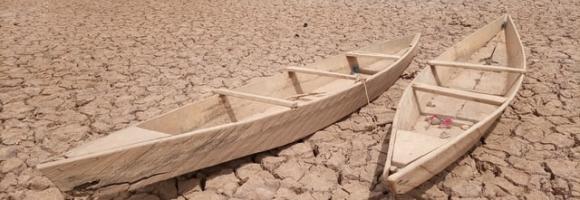
Land Degradation
Land Degradation is based on the Land productivity dynamics (LPD) product is characterized by the following five qualitative classes indicating different directions and intensity of changes:
1. Persistent severe decline in productivity
2. Persistent moderate decline in productivity
3. Stable, but stressed; persistent strong inter-annual productivity variations
4. Stable productivity
5. Persistent increase in productivity
Desertic areas and water bodies, where no productivity is detected, are not classified.
LPD is a remotely-sensed global product based on vegetation phenological metrics that are related to the land’s capacity to sustain primary production. It is derived from time series of indices of vegetation photosynthetic activity, namely the Normalized Difference Vegetation Index (NDVI), obtained from satellite data acquired by the SPOT VEGETATION sensor.